Log in
All resources
Create a design
605 Free Images of English Language Maps
eran laor cartographic collection
cc-zero
pages with maps
emanuel bowen
john cary
william hughes (geographer)
william hughes
edward weller
maps by emanuel bowen
english-language maps of africa
self-published work
pages with maps
media lacking a description
self-published work
self-published work
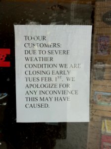
white on blue signs
self-published work
pages with maps
self-published work
pages with maps
self-published work
pages with maps
self-published work
pages with maps
self-published work
sea level rise
self-published work
pages with maps
self-published work
pages with maps
self-published work
pages with maps
sidewalk
urban
self-published work
pages with maps
old constellation maps
maps by samuel dunn
valentine's day
maps
self-published work
pages with maps
self-published work
shopping
character
symbol
eran laor cartographic collection
cornelis van baarsel
18th-century maps of the baltic sea
1770s maps of sweden
maps by john cary
county of tyrol
maps from the earth and its inhabitants, vol. vi
georgia in the 1890s
john rocque's 1746 map of london
details of old maps of london
maps of the world without antarctica
1820s maps of the world
maps by emanuel bowen
1747 maps of africa
maps by jean-baptiste bourguignon d'anville
maps by thomas kitchin
maps by john cary
1806 maps of asia
archaeological maps of north america
adena culture
maps from the earth and its inhabitants, vol. xi
1891 maps of africa
eran laor cartographic collection
english-language maps
eran laor cartographic collection
edward weller
maps by emanuel bowen
1747 maps of africa
eran laor cartographic collection
edward weller
eran laor cartographic collection
edward weller
english-language maps of africa
maps by emanuel bowen
eran laor cartographic collection
cornelis de bruyn
eran laor cartographic collection
thomas starling
eran laor cartographic collection
thomas kitchin
1810s maps of the near east
maps by john cary
eran laor cartographic collection
joseph schwarz
eran laor cartographic collection
william hughes (geographer)
18th-century maps of north america
1708 maps of north america
eran laor cartographic collection
edward weller
eran laor cartographic collection
emanuel bowen
eran laor cartographic collection
edward weller
maps by richard william seale
maps by malachy postlethwayt
eran laor cartographic collection
edward weller
eran laor cartographic collection
john cary
1810s maps of the near east
maps by john cary
eran laor cartographic collection
jacob peeters
eran laor cartographic collection
avraham leib monsohn
maps by jean-baptiste bourguignon d'anville
maps by thomas kitchin
eran laor cartographic collection
edward weller
maps by henry winkles
maps by john rapkin
maps by thomas kitchin
1782 maps of africa
maps by richard william seale
1750 maps of africa
eran laor cartographic collection
cornelis de bruyn
1747 maps of north carolina
maps by emanuel bowen
eran laor cartographic collection
romanticism
eran laor cartographic collection
william hughes (geographer)
eran laor cartographic collection
edward weller
eran laor cartographic collection
william hole (engraver)
eran laor cartographic collection
edward weller
eran laor cartographic collection
john cary
eran laor cartographic collection
william hughes (geographer)
eran laor cartographic collection
edward weller
maps of fort worth, texas
maps by henry wellge
eran laor cartographic collection
william hughes (geographer)
eran laor cartographic collection
william hughes (geographer)
eran laor cartographic collection
william hughes (geographer)
eran laor cartographic collection
john cary
eran laor cartographic collection
john cary
eran laor cartographic collection
william hughes (geographer)
eran laor cartographic collection
william hughes (geographer)
maps by john cary
1799 maps
maps by emanuel bowen
robert sayer
a map of the british empire in america with the french and spanish settlements adjacent thereto
1730s maps of the caribbean
eran laor cartographic collection
romanticism
eran laor cartographic collection
emanuel bowen
eran laor cartographic collection
william hole (engraver)
eran laor cartographic collection
cornelis de bruyn
eran laor cartographic collection
william hole (engraver)
eran laor cartographic collection
emanuel bowen
eran laor cartographic collection
john cary
eran laor cartographic collection
john cary
english-language maps from ios map collection
classicism
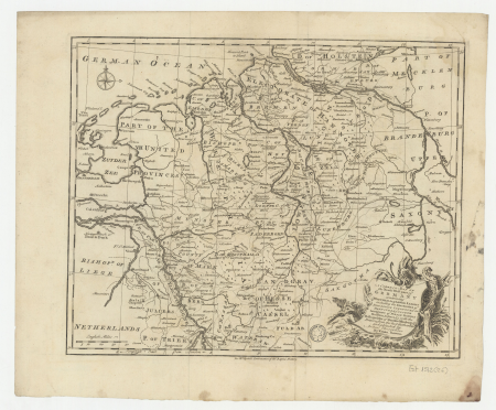
maps of the holy roman empire
1767 maps of germany
maps by emanuel bowen
1750s maps of germany
eran laor cartographic collection
michael burghers
eran laor cartographic collection
emanuel bowen
eran laor cartographic collection
michael burghers
a map of the british empire in america with the french and spanish settlements adjacent thereto
1730s maps of the caribbean
eran laor cartographic collection
emanuel bowen
eran laor cartographic collection
william hughes (geographer)
maps by thomas kitchin
1770 maps of africa
eran laor cartographic collection
william hughes (geographer)
eran laor cartographic collection
alexander anderson (illustrator)
eran laor cartographic collection
william hughes (geographer)
eran laor cartographic collection
william hole (engraver)
eran laor cartographic collection
cornelis de bruyn
101 - 200 of 605
Next page
/ 7